Geodetska kancelariјa
Geotaur
Preveri vsa mnenja, ocene, odpiralne čase ter kontaktne podatke za Geotaur, geodetska kancelariјa v mestu belgrade.

Geotaur Service Overview
At Geotaur, we pride ourselves on providing exceptional geospatial services tailored to meet our clients' needs. Our commitment to excellence is reflected in our extensive expertise and diverse range of solutions, ensuring that we can tackle any project, large or small. Here's a closer look at our key services:
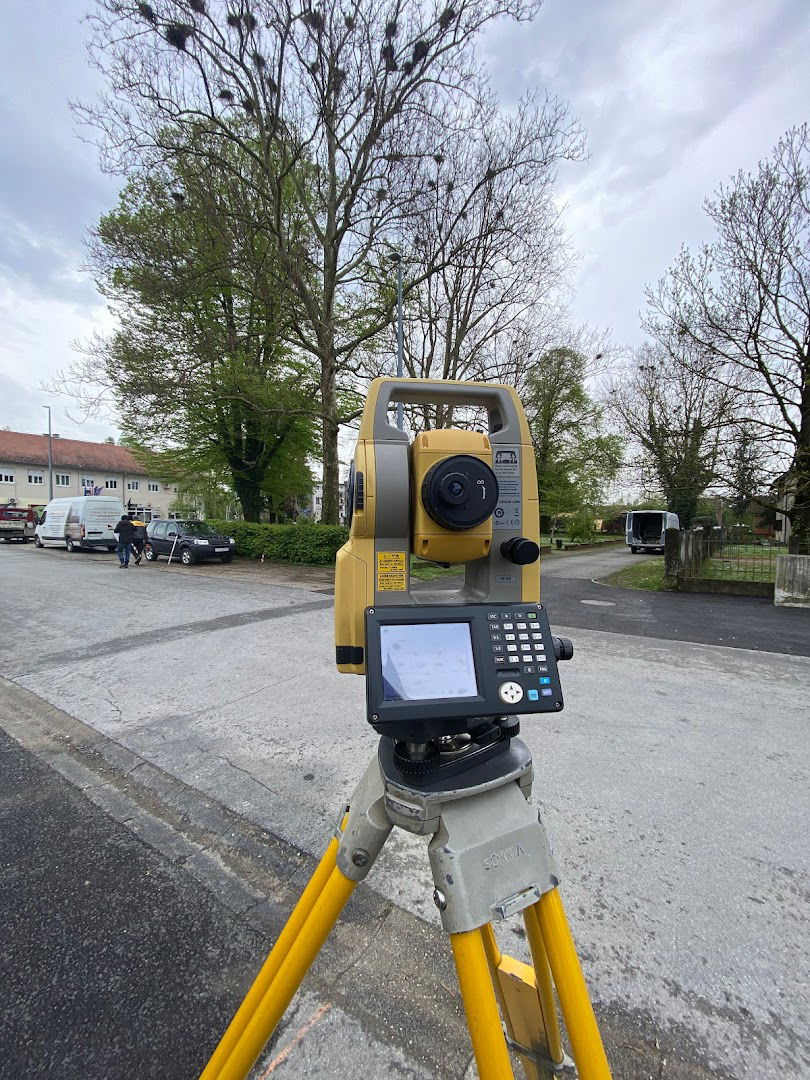
Terrestrial Laser Scanning & Data Processing
We excel in overcoming challenges related to 3D laser scanning. Our comprehensive services include scanning, point cloud registration, and the creation of detailed 3D models, 2D floor plans, facades, and various engineering drawings.
3D Modeling & Building Information Modeling (BIM)
Transforming your sketches and 2D drawings into dynamic 3D models is our specialty. We ensure precision in spatial analysis, clash detection, and promote effective collaboration within project teams by leveraging advanced software solutions to create intelligent 3D models, with levels of detail ranging from LOD 100 to LOD 350.
Airborne & Mobile Lidar
Enhance your project efficiency with our expertise in airborne and mobile laser scanning. Our experience spans LIDAR data acquisition, feature extraction, and the production of topographic plans, all designed to ease your workflow and contribute positively to your business growth.
Comprehensive Approach
Our services cater to various industries, including:
| Industry | Expertise |
|---|---|
| Open Cast Mining | 100% Professionalism |
| Oil & Gas | 100% Quality Index |
| Architecture & Building Design | 85% Product Quality Index |
| Urban Master Planning & Smart City Design | 92% Energy Generation |
| Highway Road Engineering | Experience Across Continents |
| Archeology & Cultural Heritage | Customized Solutions |
Our Vision
We believe that no task is too complicated when broken down into manageable parts. Every challenge we face is an opportunity for innovation and excellence. Our aim is to help businesses grow by minimizing risks and maximizing efficiency. Let's collaborate to achieve remarkable results together!
Sadržaјi
- Toalet: Da
- Monday 8 AM to 4 PM
- Tuesday 8 AM to 4 PM
- Wednesday 8 AM to 4 PM
- Thursday 8 AM to 4 PM
- Friday 8 AM to 4 PM
- Saturday Closed
- Sunday Closed
Podobne storitve